
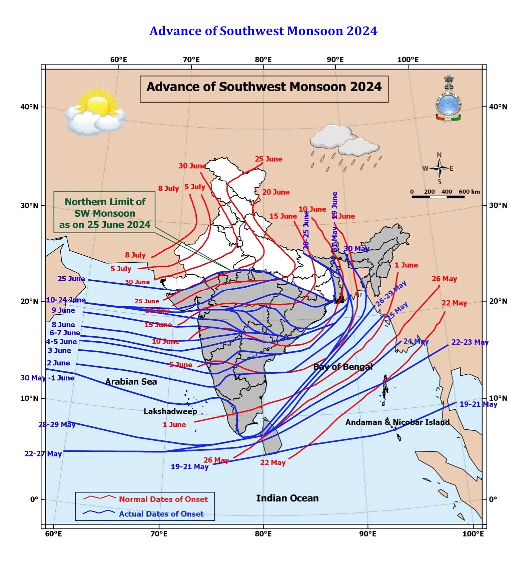
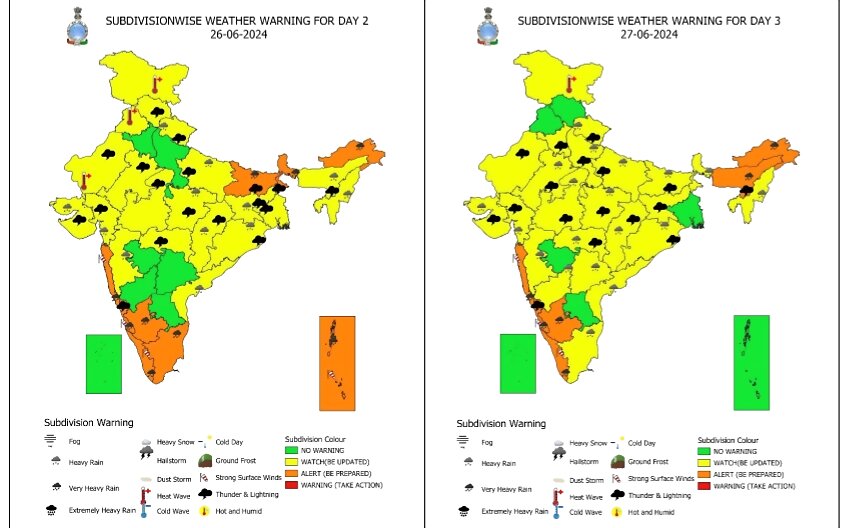
The southwest monsoon has picked up pace after a long lull phase and is forecasted to advance over North India this week. The India Meteorological Department (IMD) has also issued a heavy rainfall warning for Uttarakhand, Uttar Pradesh and Haryana from June 28-30.
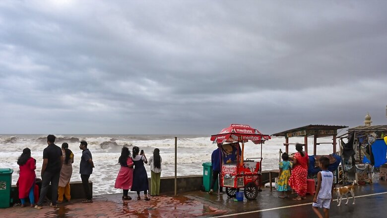
The monsoon is going full throttle over the west coast with widespread heavy rains. The western arm of the monsoon over North Arabian Sea has been particularly strong currently, pushing it further northwards. It has galloped over Gujarat with extremely heavy rains and entered further into the southern districts of Rajasthan like Udaipur and West Uttar Pradesh.
The latest forecast is clear that monsoon will continue its progress northwards and cover some more parts of Rajasthan, western Uttar Pradesh and enter Uttarakhand, Himachal Pradesh, and parts of Jammu and Kashmir as well as Ladakh over the next 3-4 days. Heavy rainfall alert has been issued for Uttarakhand for June 28-29.
The heatwave-impacted states of Punjab and Haryana could also expect the seasonal rains to commence during the next 3-4 days, however, it is the northern districts which are expected to witness the onset first. This will also bring down the temperatures by 2-4°C, providing the much-needed respite from the oppressive heat this summer.
While the weather department has not yet forecasted the monsoon onset date over Delhi this time, it is normally expected to reach the national capital by June 27. “We will announce it as soon as there is a clear signal,” said senior IMD scientist Soma Sen Roy.
The west coast of India covering states of Maharashtra, Konkan-Goa, Karnataka, Kerala, as well as Andhra Pradesh and Tamil Nadu are under heavy rainfall alert till June 29. The IMD has also issued a flash flood warning for Kerala and Mahe as well as Arunachal Pradesh with risk of inundation of low-lying areas. Heavy rains also continue over north-eastern states with an orange warning till June 29, due to adding moisture-rich winds blowing from the Bay of Bengal.
Long Lull Phase Finally Ends
Despite its early onset over Kerala, the monsoon went into a lull phase around June 12 which prolonged the deadly spell of scorching heatwaves with mercury soaring to 45-47°C. It had been trudging through Central India and reaching states slower than usual. Normally, it should reach Uttarakhand by June 20, Shimla (Himachal Pradesh) by June 24, Chandigarh by June 26 and Delhi by June 27.
As the rainfall deficit widened to 20% below long-period average (LPA) by June 20, it also led the India Meteorological Department (IMD) to revise its June rainfall forecast of normal rains and downgrade it to ‘Below-Normal’ – less than 92% of the LPA.
However, the monsoon gathered momentum around June 23 and began its progress northwards. The long dry phase over northern states also ended with an active western disturbance bringing scattered rain showers and thunderstorms over the region causing the unusually severe heatwaves to finally abate.
The MeT is confident that the monsoon’s eastern arm will also cover remaining parts of Chhattisgarh, Bihar, West Bengal, and Jharkhand as well as Madhya Pradesh this week. As of Tuesday, the northern limit of the monsoon passes through Mundra and Mehsana (Gujarat), Udaipur (Rajasthan), Shivpuri and Siddhi (Madhya Pradesh), Chaibasa (Jharkhand), Haldia (West Bengal) and Raxaul (Bihar).


Comments
0 comment