
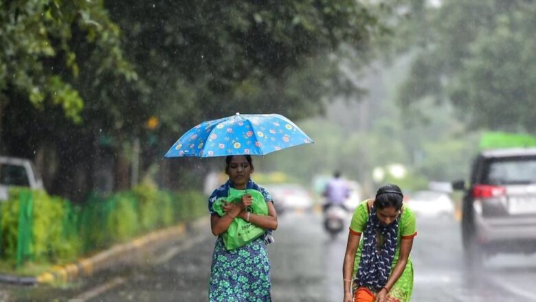
Several areas of east and central India are expected to witness heavy to very heavy rainfall for the coming three days, a recent prediction by the India Meteorological Department has noted. As per the IMD, a low-pressure area lies over the Northeast Bay of Bengal and neighbourhood and is likely to concentrate into a deep depression by August 19 morning to bring heavy rain to Odisha.
On the other hand, subdued rainfall over southern parts of the Peninsula is likely to continue during the next five days. The western end of the monsoon is expected to shift to the north of the normal position from August 19 and is likely to remain so during the next two to three days, while the eastern end is likely to be along normal or south of the normal position during the same period.
Rainfall Prediction in Eastern India:
The India Meteorological Department (IMD) on Friday rejected the possibility of any cyclone after the depression in the Bay of Bengal intensified into a deep depression bringing rainfall to Odisha and West Bengal. There is no possibility of a cyclone this time. We have never said that the system will take the shape of a cyclone, IMD Director General Mrutunjay Mohapatra told PTI. The system will move along the coast as a deep depression at a wind speed of 60 to 65 kmph and it is unlikely to intensify further, he said.
Meanwhile, the Ranchi Meteorological Centre has issued a red alert’ for parts of Jharkhand, where heavy rainfall is likely from Friday evening due to the impact of a deep depression over the Bay of Bengal, officials said. Heavy to very heavy rainfall might continue till Saturday in many parts of the state, they said.
A red alert’ (07-20 cm rainfall) has been issued for Saraikela-Kharswan, East and West Singhbhum districts, the officials said, adding, some districts in west and central Jharkhand might also experience heavy to very heavy rainfall. The deep depression over Bay of Bengal is likely to cross West Bengal and Odisha coasts between Balasore and Sagar Islands around Friday evening.
The north-east, south-east and northern parts of the state might experience lightning activity coupled with strong winds (30-55 kmph), the officials said. After landfall, it would continue to move west-northwestwards across north Odisha, West Bengal and Jharkhand towards north Chhattisgarh and weaken gradually, Ranchi Meteorological Centre In-Charge Abhishek Anand told PTI.
Western India:
The Meteorological Department here has predicted a fresh round of heavy rains for several areas of Rajasthan from this weekend due to a new pressure system formed along the coast of Bay of Bengal and Bangladesh. However, the rain activities in the state have slowed down in the last 24 hours
On August 21-22, most parts of Kota, Udaipur, Jaipur, Bharatpur and Ajmer divisions of the state are likely to receive rain and heavy to very heavy rainfall at some places. Similarly, there is a possibility of light rain at isolated places and mainly dry weather in most parts of west Rajasthan for the next two days. In the districts of Jodhpur, Bikaner division, there will be an increase in rain activities from August 21-22 and the system of heavy rains will be active again on August 22-23.
The weather department on Thursday issued an orange alert for Bhandara, Gondia, Gadchiroli and Nagpur districts of Vidarbha, warning of “very heavy rainfall” in some places. The Regional Weather Forecasting Centre, Nagpur, said rainfall activity was very likely to increase over Vidarbha on July 20-21.
Heavy to very heavy rainfall was likely in Vidarbha on Saturday and Sunday and very heavy rainfall was likely to occur at isolated places over Bhandara, Gondia, Gadchiroli and Nagpur districts, it said.
Rainfall Predictions in Northern India:
The Northwestern Himalayan region and the northern plains are also likely to receive heavy rainfall.
The IMD has forecast fairly widespread to widespread light or moderate showers with lightning-laden thunderstorms over Uttarakhand and East Uttar Pradesh on Friday and Saturday (August 19-20), Himachal Pradesh and West Uttar Pradesh from Friday to Sunday (August 19-21), Jammu-Kashmir and Punjab on Saturday, East Rajasthan from Saturday to Monday (August 20-22), south Haryana on Sunday, and over West Rajasthan on Monday.
Southern India:
Kerala is likely to witness a spell of heavy rainfall accompanied by thunder and lightning for the next five days (until August 22). Rain with thunder and lightning is likely at isolated places in the state from August 18-22, the India Meteorological Department (IMD) said.
(With inputs from Manoj Jena )
Read the Latest News and Breaking News here


Comments
0 comment