
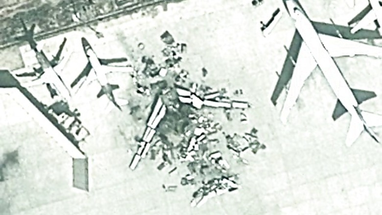
New Delhi: Pakistan's Jinnah International Airport on Sunday was attacked by Taliban militants and at least 27 people were killed in a night-long battle. While the Pakistan authorities state that no planes were damaged during the attack, Google Maps satellite images show an airplane in the parking bay blown to pieces. (See the screenshots below)
 These Google Maps satellite images have been doing the rounds since the attack at Pakistan's busiest airport took place on Sunday. However, the date and time of these satellite images can not be verified.There is no confirmation whether these images were taken during or after the terror attack. Rizwan Akhtar, the chief of Pakistan's elite paramilitary Rangers said that a cargo building was left completely gutted by the fire and the explosions, but no planes were damaged. The attack began just before midnight when 10 gunmen wearing military uniforms and armed with automatic rifles and rocket-propelled grenades shot their way into the airport's old terminal, which is used mainly for charter and executive flights. Gun battles raged through the night until security forces regained control of the airport at dawn. Passengers were evacuated and all flights were diverted. By dawn on Monday, the army said the airport had been secured but heavy smoke rose above the building.


Comments
0 comment