views
Native Land Digital Website
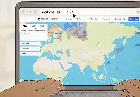
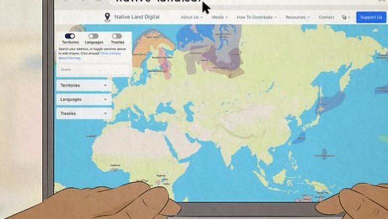
Visit the Native Land Digital website at native-land.ca. Native Land Digital is a Canadian not-for-profit company, so the main website is registered to a “.ca” domain. The home page directs you to a large, digital map of the entire world, covered with colored digital layers that mark different indigenous territories. You can visit the site here: https://native-land.ca/ Keep in mind that this map doesn’t represent the exact legal boundaries of each indigenous community. Instead, it’s designed to provide a geographical scope.
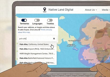
Type your location into the “Search” bar. Find the search bar in the top-left corner of the map and type in either your zip code, city and state, or city and province. Then, hit the “Enter” or “Return” button on your keyboard. Native Land Digital works just like your typical digital navigation app—think Google Maps or Apple Maps.
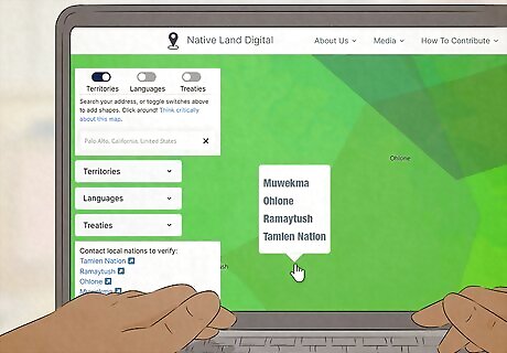
Identify which indigenous land your home sits on. The Native Land Digital map should zoom in on your exact location. By default, the map interface doesn’t have any state or provincial borders listed, but you can bring up the standard city, town, and interstate labels by clicking on the “Labels” button on the bottom-right corner of your map. Here are a few examples of some results you could come up with: Montréal, Quebec, Canada: Kanienʼkehá꞉ka (Mohawk) Anchorage, Alaska, United States: Denendeh Jacksonville, Florida, United States: Timucua Palo Alto, California, United States: Tamien Nation, Ramaytush, Ohlone, and Muwekma
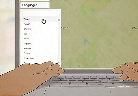
Switch on the “Languages” toggle to explore indigenous languages. Toggle off the “Territories” app so you don’t have as many overlapping layers on the digital map. Then, click on “Languages” to see which indigenous languages are native to your area. Here are a few possible results you might stumble across: Santa Fe, New Mexico, United States: Tewa language Billings, Montana, United States: Dakȟóta (Western Dakota), Crow, Dakȟóta (Eastern Dakota), Lakȟótiyapi (Lakota), and Cheyenne languages Edmonton, Alberta, Canada: Michif and Nēhiyawēwin (Plains Cree) languages Thompson, Manitoba, Canada: Woods and Rocky Cree language
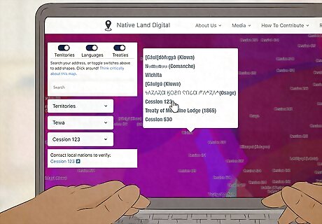
Get more historical context with the “Treaties” toggle feature. This feature gives you a birds-eye-view of the different treaties made with indigenous people throughout history. Toggle off the “Territories” and “Languages” switches and click on the “Treaties” toggle instead. Type in your zip code or city and state/province as you did before. Your area might not have any relevant historical treaties, but there’s only one way to find out! Here are a few examples of treaties you might stumble across: Halifax, Nova Scotia, Canada: Peace and Friendship Hopedale, Newfoundland and Labrador, Canada: Nunatsiavut Land Claims Agreement Wichita, Kansas, United States: Cession 123, Treaty of Medicine Lodge (1865), and Cession 476 Portland, Oregon, United States: Cession 352
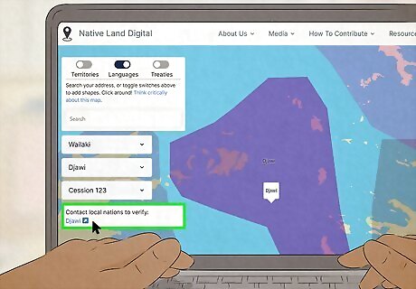
Click on the link of the indigenous territory to get more specific information. Look on the left-hand side of your map—you should see a white box labeled “Contact Local Nations to Verify” along with a blue hyperlink for the indigenous territory that overlaps with your location. Click on this blue link to get redirected to a page with specific info about that indigenous community. You may find: Relevant websites Related maps Images Sources
Native Land App
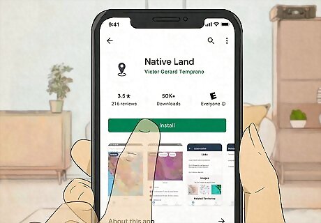
Search “Native Land” in the App Store or Google Play Store. The app should be listed as “Native Land,” with “Victor Gerard Temprano” listed as the publisher or developer. Tap the download button to install the app on your phone or mobile device. The iOS app only takes up 17 MB of space, and works on both iPhone and iPad. You can find it in the “Education” category of the App Store. The Android app takes up 38 MB of space, and can be found in the “Maps and Navigation” category of the Play Store. The developer is very responsive and replies consistently to reviews and feedback in both the App Store and Play Store.
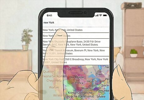
Use the “Search” bar to see which indigenous land overlaps with your home. The mobile app works the same way as the desktop site—just type in your zip code or city and state/province in the “Search” bar along the top of your screen. The interactive map will automatically zoom in on your location, so you can find out what indigenous land your town is on. You should see a color-coded legend at the bottom of your screen, which tells which indigenous land (or lands) your location overlaps with.
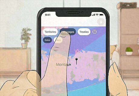
Hit the “Languages” or “Treaties” buttons to learn even more about where you live. Tapping “Languages” or “Treaties” automatically toggles off the previous layers and recalibrates the map with the correct set of layers.
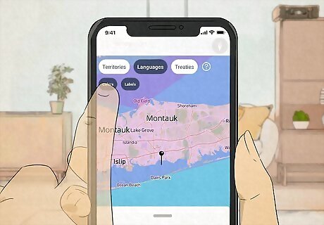
Tap the color-coded label of each indigenous territory to pull up more information. Look for a colored map legend along the bottom of your phone screen—this should include any indigenous territories overlapping with the location you searched. Tap on the territory name to get redirected to an informational page about that specific community. This informational page includes: A smaller map that highlights the total size and scope of the selected indigenous territory Related web links Images Related territories
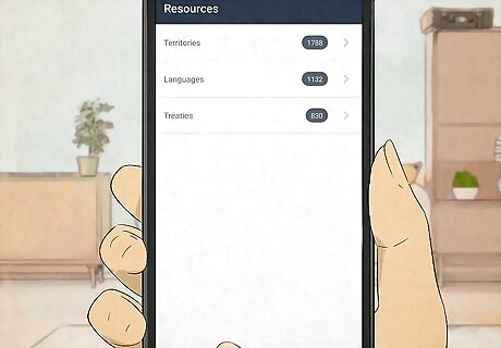
Select the “Resources” button for a directory of info on all indigenous communities. Look along the bottom of your phone screen for a mini menu with 3 buttons: Map, Resources, and About. Tap the “Resources” button to get redirected to a directory page with 3 options: Territories, Languages, and Treaties. Tap on any of these options to pull up a comprehensive list of all the territories, languages, and treaties represented in the app. Tap on the individual territory, language, or treaty name to pull even more information.
Facebook Messenger and Text
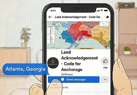
Send your zip code or city and state to a specific Facebook page. Open up the Facebook website or app and search “Land Acknowledgement - Code for Anchorage” in the search bar. The Land Acknowledgement page is a bot programmed with data directly from Native Land Digital. Then, type in your zip code or city and state/province in the chat window. For instance, you might send the message “Atlanta, Georgia” or “10001” to the page on your computer or through the mobile Facebook Messenger app. You can also type in your location on this site to get a customized result: https://land.codeforanchorage.org/
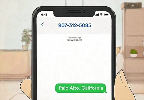
Text your location to 907-312-5085 if you don’t use Facebook. This phone number connects you to the same bot attached to the “Land Management” Facebook page. Just type in your postal code or city and state/province, and then press “send.” This is a US-based phone number. If you text this number from Canada, you may end up getting charged with extra fees.
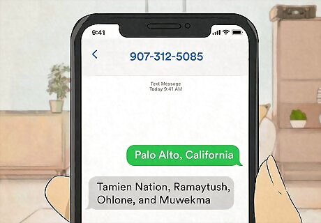
Wait for a response from the bot. The bot should reply in a matter of moments with the name of the indigenous land your location is on. Keep in mind that you might get more than 1 result, depending on where you live.






Comments
0 comment