views
X
Research source
Using a Bar Scale
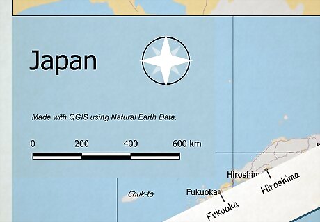
Mark the 2 points on the edge of a sheet of paper. Take a blank sheet of paper and line up the edge between the 2 points that you want to measure the straight-line distance between. Make a tick mark on the paper for the first point, then another tick mark for the second point. It's helpful to label each of the 2 points so you remember which tick mark goes where, but this isn't strictly necessary since the distance will be the same in either direction.
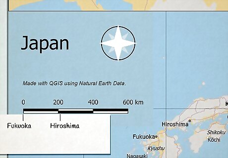
Place your paper underneath the map's bar scale. The bar scale is a black or gray bar, typically at the bottom of the map. Place the tick mark for the first point directly under the 0 on the bar scale. The 0 might not be all the way on the left edge of the bar scale. Some bar scales include fractional distances to the left of the 0. Bar scales typically have distance measurements in both kilometers and miles, so make sure you're on the right one. The units used locally will likely be the most helpful since road signs would be in the same units. However, if you're not familiar with that system, you might want to get a measurement with both.
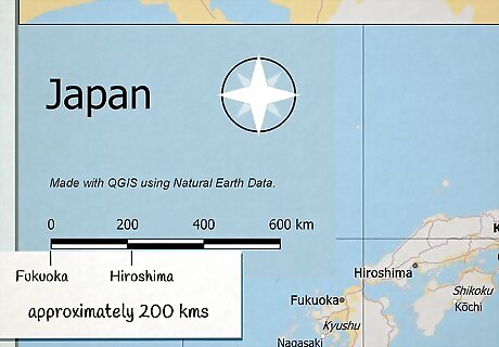
Read the distance between the 2 points on the scale. Locate the tick mark you made for the second point on your piece of paper and look at the bar scale. The number above that tick mark on the bar scale is the real-world distance between the 2 points. For example, suppose you have a 10-kilometer bar scale that's marked off in 2-kilometer segments. The number over your tick mark is 8. Therefore, your 2 points are 8 kilometers apart. If there isn't a number directly over the tick mark, you'll have to estimate. Some bar scales have fractional distances to the left of the 0 that will help you to estimate. For example, suppose you have a 10-kilometer scale that isn't segmented, but your tick mark is halfway between the 0-point and the end. Your points are approximately 5 kilometers apart.
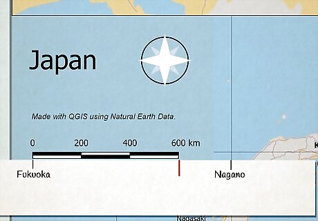
Create segments if your distance is longer than the bar scale. Most distances you try to measure will be longer than the bar scale, but you can still measure them. Make a tick mark on your paper where the bar scale ends and write the distance underneath it. Then, slide your paper over so the tick mark you just made is directly under the 0 on the bar scale. If the second point is still further than the scale, make another tick mark and move the paper over again. Keep going like that until you reach your destination.
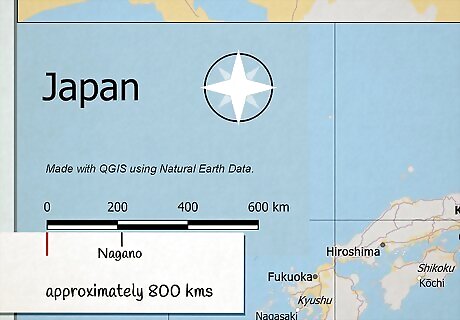
Add up your segments to determine the total distance. For distances that are longer than the bar scale on the map, take the distance represented by each of the segments you made and add them all together. That tells you the total distance from the first point to the second point. For example, suppose you have a 10-kilometer bar scale. You've measured 3 10-kilometer segments and one segment you estimate to be half of the bar scale, or 5 kilometers. Your total distance between the points would be 35 kilometers (10 + 10 + 10 + 5).
Calculating Distance with a Fractional Scale
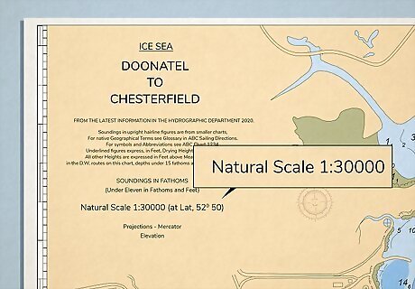
Look for the fractional scale on the map. A fractional scale, as the name implies, is expressed as a fraction, typically at the bottom of the map. Sometimes, it's also expressed as a ratio, but the calculations are the same regardless. Maps have different scales for different purposes. For example, a road map is typically drawn at a 1:250,000 scale. It shows a larger area with roads and towns, more suitable for driving. A walking map, on the other hand, might be drawn at a 1:25,000 scale, providing more detail about paths and landmarks in a smaller area.
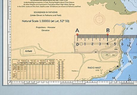
Measure the map distance between the 2 points. Use a ruler as a straight edge between the 2 points you want to find the straight-line distance between. Place the 0-edge of the ruler at the first point, then mark the measurement listed at the second point. Since you're using a fractional scale, the number you find becomes the numerator, or top number, of your fraction. If you're using a road map drawn to a 1/250,000 scale, and the distance between your 2 points is 5, your 5 takes the position of the 1 on the scale. Then, you'll have to find the total ground distance that represents.
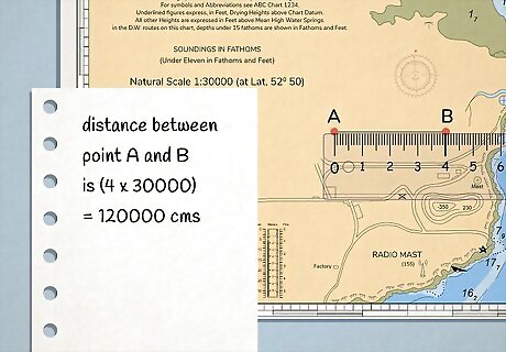
Cross-multiply by the scale to find the ground measurement. Set up your fraction so that the unit measurement you found is the numerator and "x" is your denominator. Multiply the denominator of the scale by the unit measurement you found to determine the ground measurement. To continue with the previous example, if you found 5 as the distance between your 2 points, you would multiply 5 by 250,000 to get 1,250,000. So if you used inches, the 2 points are 1,250,000 inches apart from each other. Similarly, if you used centimeters, the 2 points are 1,250,000 centimeters apart from each other. The unit makes no difference.
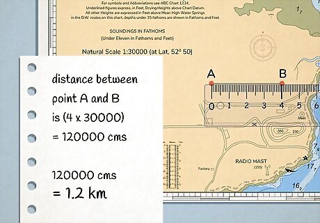
Convert your answer into the unit of your choice. The fractional scale tells you the real-world distance in centimeters or inches. To make your answer more usable, divide centimeters by 100 for meters or 100,000 for kilometers. If you're working in inches, divide by 12 to find feet or 63,360 to find kilometers. For example, you would be unlikely to say that 2 points were 1,250,000 centimeters apart. Instead, you would likely want to convert those centimeters to meters or kilometers. When you did so, you would find that the 2 points are 12,500 meters (1,250,000/100) or 12.5 kilometers (1,250,000/100,000). Similarly, if you used inches, the 2 points would be 1,250,000 inches apart, which converts to approximately 104,167 feet (1,250,000/12) or 19.7 miles (1,250,000/63,360).
Finding Road Distance
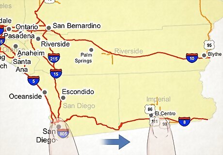
Identify the road or roads between the 2 points. Place your finger on the starting point and find a road that goes in the direction of your ending point. Trace your finger down the road to find the route you would need to take between the 2 points. You may need to take more than one road — especially if the 2 points are far away from each other. To keep track of your route, trace it in pencil or take notes on a separate sheet of paper.
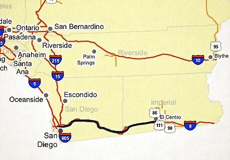
Place a string along the route. Put the end of the string at the first point and lay it down directly over the roads you would take if you were traveling to the other point. For curves, hold the string to follow the curve and then move your finger to the furthest point. It can help if you have a friend with you to help you hold the string. However, you don't need to hold it down all the way from the beginning. If you're going around a curve, just make sure you're holding down the string at the furthest spot you've gone so far.
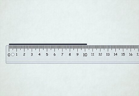
Measure the total length of your string. Hold the string at the point where it reaches the second point. The length of the string from the end to that spot represents the road distance on the map. Use a ruler or tape measure to get the total length of the string. You can also mark the string with a pen or use a piece of tape. That way, you don't have to worry about dropping the string and losing your spot.
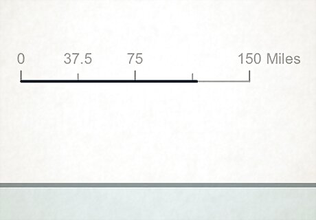
Use the bar scale to measure your string if you don't have a ruler. Get something to take notes so you can keep track of segments, then place the start of the string at the 0-point of the map's bar scale. Extend the string to the end of the bar scale and place your finger there. Right down the distance represented by the full length of the bar scale, then move the place where your finger is to the 0-point of the bar scale and do it again. Keep going until you reach the place on your string that marked your destination. For example, suppose the map has a bar scale that's 8 kilometers long. Your string has 4 segments the length of the bar scale, plus another segment about half the length of the bar scale before you reach the spot on the string for your destination. The distance between the 2 points is 36 kilometers (8 x 4 + 4). Be careful not to stretch the string any tighter than you did when you were measuring, or your final distance measurement will be off.
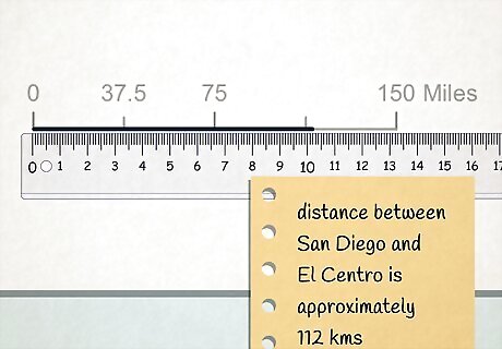
Calculate the distance using the map's scale. If you measured your string with a ruler, use the map's fractional scale to find out the real-world distance by multiplying the string's measurement by the number in the denominator of the fraction or right side of the ratio. Then, convert that number to a larger unit, such as miles or kilometers. For example, suppose you found your string is 7 centimeters long and the map you're using has a scale of 1:250,000. Multiplying 7 by 250,000 gives you a real-world distance of 1,750,000 centimeters, which is likely not very helpful. If you divide that number by 100,000, however, you find that your points are 17.5 kilometers apart. If you used the bar scale to find the length of your string, you don't need to do this step because you already have the real-world distance.
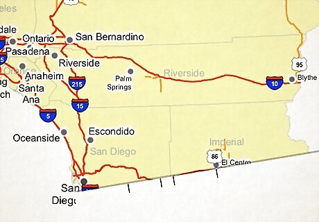
Use a piece of paper to measure segments if you don't have string. A string is ideal to measure a curvy road because it can follow the curves of the road. If you don't have a string handy, take a piece of paper and make a tick mark on the edge at your starting point. Then, follow the road until it curves. Place a tick mark at the curve, then pivot the paper until it's following the road again, holding it in place where you marked the curve. Mark the spot where it curves again and follow the same procedure until you reach the endpoint on the map, always keeping the edge of your paper against the road edge. When you get done, you'll have multiple tick marks on the edge of your sheet of paper. Hold these to the scale to find the distance for each segment. Then, add them together to find the distance between the 2 points. This method may not be as accurate as the string method, but in a pinch, it's better than nothing.






Comments
0 comment